Public layers
Satellite imagery, forest, tree loss, soils, street map and more. Each layer lists its source and licence, and you set how see-through it is.
Blocks, water, field work and costs in one place, so daily decisions and new planting use the same records. Those records are also the evidence sustainability audits ask for. We are working towards ISPO and RSPO so that compliance takes little extra work. That is the aim, not something the platform does today, and it holds no certification.
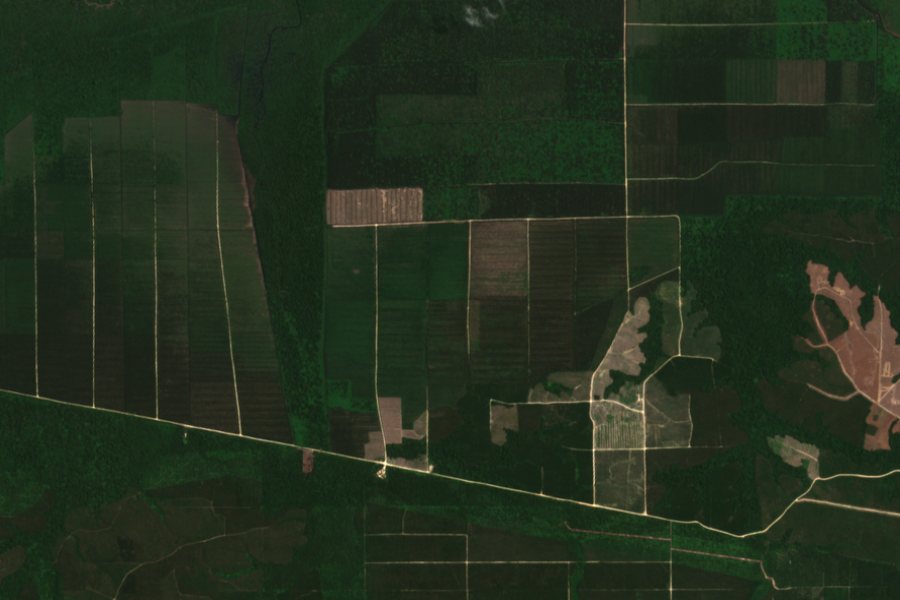
Imagery: Copernicus Sentinel-2. Contains modified Copernicus Sentinel data 2023, cropped with example blocks added.
Satellite imagery, forest, tree loss, soils, street map and more. Each layer lists its source and licence, and you set how see-through it is.
Current temperature and cloud cover, and the expected rain over the next 24 hours, at the sample location. Data from Open-Meteo.
A layout of 24 invented blocks coloured by status: mature, immature, replant, new planting or fallow. It shows how a block map reads and holds no real estate data.
Every figure in the drawings below is an example, not a real estate.
One screen after sign-in: blocks monitored, blocks to act on, open scouting and work orders, the last flight and the rain this week. Each number opens its list and shows how many blocks it covers and how old it is.
A flight is indexed from its coordinates and stitched on a separate worker into one orthomosaic. That part is built. Picking a flight folder and uploading it from the site, with a resumable queue, is still coming.
Lay out a road grid and canals against the slope of the land. The planner adds clearing, mounds and equipment time, then gives a bill of quantities you can export. Costs start from a default rate card and are estimates.
Every block is ranked act, watch, ok or unknown, with the reason and the age of the data. Stale or missing readings give unknown, never ok. The thresholds still need an agronomist to confirm them, and the water balance is labelled as modelled.
Send someone to a block with a clear task. A work order closes with a located photo or a reading, a manager verifies it, and a re-check is scheduled so the result shows on the block.
The engine scores fault classes from evidence and shows what moved each one, so a person can judge it and raise a ticket. Rules are versioned and a change needs a second person. The starting weights are estimates, not yet field-validated. Evidence collectors and the screens are still coming.
A bot on web and Telegram, Indonesian first. It answers only within the asker's scope, takes numbers only from the platform or says there is no data, and can only propose a change: a person confirms it in the app.
A role is granted at a scope. Someone invited to one division sees that division and nothing else, and the last admin of a company cannot be removed. Roles, invite links and scope checks are built. The members screen and the contractor role are coming.
A planting crew sends the block, row and a photo. The record becomes a tree ID that follows the palm from planting through immature and mature years to replanting.
Lay pipes over the terrain, then see pipe losses and pump operation, and set a schedule that takes the weather forecast into account.
One view of what each requirement needs, which records already answer it and what is missing. We are working towards ISPO and RSPO. This view would not certify anyone, and an auditor still decides.
Pick imagery, forest, tree loss, soils or the street map, and set how see-through it is.
Each layer shows who published it and under which licence.
Open the estate panel for the temperature, cloud cover and the rain forecast.
Each layer and weather reading names where it came from.
A missing value says "no data" and why. It never shows a zero.
The blocks are invented. No customer estate data is shown.
The blocks are invented. No customer data is shown.